
The Rhine is one of Europe's most iconic rivers. Starting in the Swiss Alps, it flows for around 1,230 kilometres before splitting into its Dutch delta, passing through six countries along the way.
The Rhine offers something genuinely varied for independent travellers visiting Germany: ancient cathedral cities, a dramatic gorge lined with medieval castles, working industrial ports and some of the country's most famous wine regions.

Vineyards near Rüdesheim above the Rhine river
The German section covers the most historically significant stretch of the river. The river changes character several times over, from the flat plains of the Upper Rhine to the steep slate cliffs of the Mittelrhein gorge and the broad urban lowlands near the Dutch border. It is difficult to take all of this in on a single trip.
Most visitors tend to focus on the Middle Rhine Valley, the section of the river between Bingen and Koblenz that has been designated a UNESCO World Heritage Site.
This is entirely understandable. But the towns further south and the cities further north each offer something unique that the gorge does not.
The river Rhine, known as the Rhein in German, has played a greater role in shaping the country's history than almost any other geographical feature. It has served as a frontier for the Roman Empire, a medieval trade route and a political boundary contested by Germany and France for centuries.
Today, it is one of the world's busiest commercial waterways, with freight barges and tourist boats moving continuously up and down it.
The Rhine flows across the flat Upper Rhine Plain to the south of Mainz, flanked by the Black Forest to the east and the Vosges to the west. This stretch of the river is wide and calm, and the surrounding landscape is open and agricultural.
Everything changes between Bingen and Koblenz. The river cuts a narrow, winding gorge through the Rhenish Slate Mountains. Vineyards climb the steep hillsides. Castles dot almost every ridge. This is the section of the river that most people picture when they think of the Rhine.
The hills recede north of Koblenz. The valley opens into a broad plain by Cologne. Further north, the landscape becomes completely flat, blending into the Niederrhein lowlands and the Netherlands with no clear geographical boundary.
The most visited sections of the Rhine are well served by public transport, but this is less common at the river's edges. Regional trains run along both sides of the river through the gorge. River ferries connect towns that have no direct road link.
Expect crowds in the summer months between Rüdesheim and Koblenz. The gorge towns are popular with river cruise passengers, coach tour groups and weekend visitors from German cities. Arriving early or staying overnight allows you to enjoy the same views without the midday crowds.
The Upper Rhine is approximately 360 kilometres long and runs from Basel north to Bingen. Most of its course through Germany is through a broad, flat-floored valley between the uplands of the Black Forest and the Palatinate Forest.
Although this stretch receives far fewer visitors than the gorge to the north, it contains some of Germany's most historically significant cities. The wine towns and imperial cathedral cities here form a distinct travel route.
The river straightens and widens below Basel. Much of its upper course was artificially modified in the 19th century, eliminating the dramatic meanders that once characterised this section. The result is a river that feels managed and industrial in places, but the towns set back from the water often compensate for this.
Konstanz and Lake Constance mark the river's origins, and the main German stretch picks up character further north, near the wine-producing areas of Baden.
These three cities embody the essence of the Imperial Rhine. Speyer's cathedral is one of the finest in Germany and among the largest surviving Romanesque churches in the world.
Worms has equal historical significance. The Diet of Worms took place here in 1521, when Martin Luther refused to recant. The cathedral is another impressive Romanesque building.
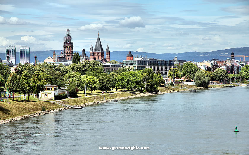
A view of Mainz across the Rhine river
Mainz is located where the Main River meets the Rhine. It is a working city with a historic old town, a significant cathedral and the Gutenberg Museum. The city is a convenient base for exploring both the Upper and Middle Rhine regions.
The UNESCO-listed Upper Middle Rhine Valley extends for around 65 kilometres between Bingen and Koblenz.
This stretch is most closely associated with the Romantic Rhine, with its narrow gorges, steep slate cliffs, more than 40 hilltop castles and ruins, and small towns wedged between the water and the hillside.
The castles were built primarily to control river traffic and levy tolls, which is why so many of them survive so close together. This dense concentration of history is best appreciated at a slower pace rather than during a single long day trip.
Its designation as a UNESCO World Heritage Site in 2002 recognised its genuinely unusual combination of natural landscape, cultural heritage and winemaking history. The river winds sharply and repeatedly through the gorge. The view changes every few minutes, whether travelling by boat, train or road.
The wine produced on these steep slopes is predominantly Riesling. The steep gradient of the vineyards makes mechanical work difficult, which keeps yields low and quality high.
Rüdesheim am Rhein is the most commercially developed town in the valley. The Drosselgasse, a narrow pedestrian street lined with wine bars, attracts large numbers of visitors in the summer months. The town can feel overwhelmed in peak season.
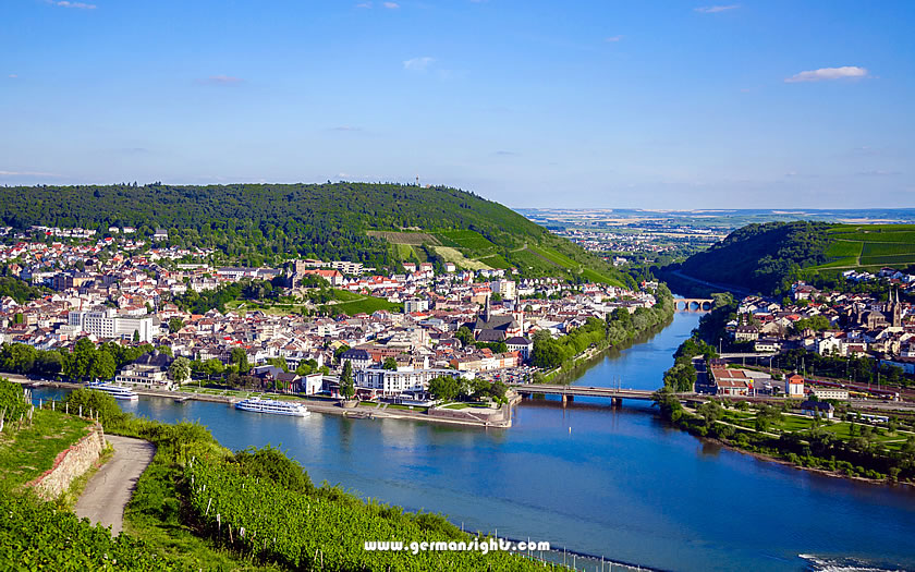
A view of Bingen and the river Rhine
Bingen is located directly opposite on the left bank. It is quieter and more down-to-earth. The town marks the point where the Rhine begins to turn north and the gorge starts in earnest.
Bacharach is one of the best-preserved half-timbered towns on the Rhine. Much of the town centre is still surrounded by medieval walls, and the hillside above is home to Stahleck Castle, now a youth hostel. It is less visited than Rüdesheim, meaning it has retained its authentic character.

A view of Bacharach and the Rhine river
Kaub is home to one of the most photographed sights in the gorge: Pfalzgrafenstein Castle, a toll fortress built on a rock island in the middle of the river. Burg Gutenfels looms large above it on the hillside.
Oberwesel retains its medieval town walls and the unusual red exterior of the Church of Our Lady. The town itself is small enough to walk around in an hour, but the surrounding vineyards and the views from the walls make it worth a visit.
Rheinfels Castle, located above St. Goar, is the largest castle ruin in the Middle Rhine Gorge. Its impressive size is evident in the complex of walls, towers and underground passages spread across the hillside.
Burg Katz and Burg Maus, which are in better structural condition, are visible from the water nearby. Marksburg Castle, located a short distance north of Braubach, is the only Rhine castle never to have been destroyed, meaning its interior is intact.
Loreley Rock is located at the most famous bend in the river, where the water narrows and the current is fast-moving. The legend of the Loreley, a siren who lured boatmen to their deaths, originated in the 19th century rather than in ancient times.
Nearby, the Vierseenblick viewpoint provides a panorama where the river bends so sharply that it appears to be four separate lakes.
Boppard is one of the largest towns in the gorge, and is an ideal base for exploring the valley by train, boat or on foot. The remains of the Roman fort walls can still be seen at street level. Situated on a wide bend in the river, the town has more open space than some of the narrower settlements in the gorge.
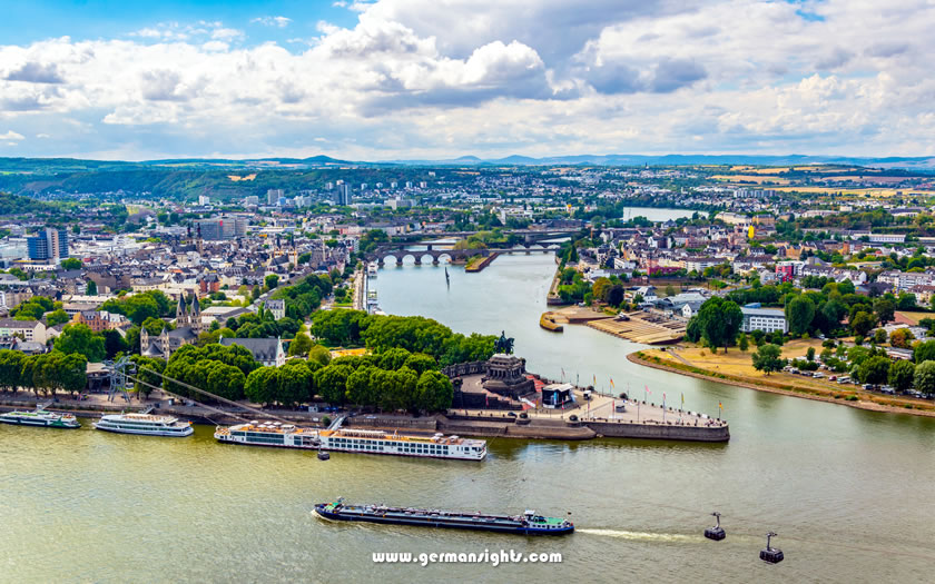
A view over the Mosel and Rhine at Koblenz
Koblenz marks the northernmost point of the UNESCO-listed area, where the Moselle river and the Rhine converge at the Deutsches Eck. This is a prominent promontory with a large equestrian statue.
The Ehrenbreitstein Fortress is located on the opposite bank and can be accessed by cable car.
Koblenz is a proper city rather than just a stop for river tourism. It offers a reasonable range of accommodation and good rail connections in multiple directions.
The Rhine gradually loses its gorge character below Koblenz. The hills recede, the valley widens and the river becomes increasingly industrialised as it passes through North Rhine-Westphalia. This section is less popular with leisure travellers, but it is the economic core of the river's role as a European freight transport route.
Bonn served as the federal capital of West Germany until 1999. It has a compact, walkable old town and several significant museums along the Museumsmeile, as well as Beethoven's birthplace. The city is often overlooked by travellers rushing between the Rhine Gorge and Cologne, but it deserves at least a full day's exploration.
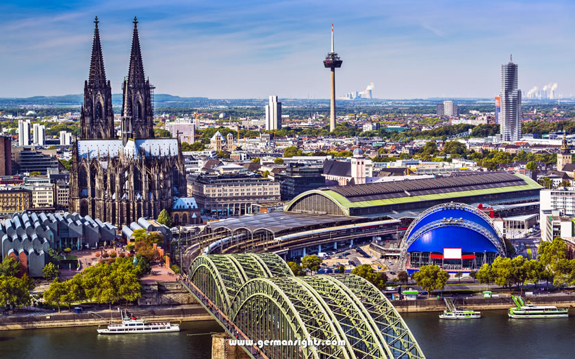
View over the centre of Cologne
As the major city on the Rhine, Cologne is an obvious base for anyone exploring the lower river. The Gothic cathedral, the Dom, took over 600 years to complete and dominates the skyline from across the water. The city is also home to the Romano-Germanic Museum, which boasts an impressive collection of Roman artefacts from the Rhineland.
Cologne is a lively city with a strong bar and restaurant presence, and not merely a heritage stop.
Further downstream from Cologne, the Rhine is a wide river, busy with freight traffic and flanked by chemical plants and refineries. This is not the Rhine Valley as depicted in tourist brochures.
Leverkusen, Dormagen and Neuss are industrial centres rather than tourist destinations. The landscape is flat, and the riverbanks are largely functional.
Düsseldorf is the capital of the state of North Rhine-Westphalia and a major commercial centre.
The old town, or Altstadt, runs alongside the Rhine and boasts a high concentration of bars and restaurants. The Königsallee shopping boulevard reflects the city's wealth.
It is worth a visit in its own right, rather than just as a Rhine attraction.
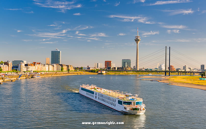
The Rhine river at Düsseldorf
Duisburg is located where the Ruhr river and the Rhine converge. The former steelworks of the Landschaftspark Duisburg-Nord, now converted into a public park, offer visitors one of the region's more unusual experiences.
From here, the river continues to the Dutch border at Emmerich and then splits into the Waal, the Lek and the Merwede, finally reaching Rotterdam and the North Sea.
Travelling along the Rhine is genuinely practical for independent travellers who do a little advance planning.
The main options are river ferries, regional trains and road transport. Cross-river ferries connect the two riverbanks where there is no bridge. The way each works depends on which section of the river you are covering.
Köln-Düsseldorfer, commonly known as KD, operates the main scheduled passenger boat services on the Rhine. In the gorge section, boats run between Mainz, Bingen, Rüdesheim, Bacharach, Boppard, St Goar and Koblenz. Services are seasonal, with the highest frequency in summer.
The full journey from Mainz to Koblenz takes around five hours downstream and longer going back upstream.
Taking the boat is a pleasant experience for part of the journey, but it is slow compared to the train. Most independent travellers use it in one direction on a specific stretch, rather than as their main way of travelling between towns.
This is the most efficient way to explore the gorge. Regional trains run along both sides of the Rhine through the Mittelrhein region, stopping at most of the major towns.
The line on the left bank runs through Bingen, Bacharach, Oberwesel, Boppard and Koblenz. The right bank line serves Rüdesheim, Assmannshausen and Kaub, among others.
The trains are frequent and cheap with a regional day ticket. They are also fast enough to travel between towns without wasting a whole day.
Crossing the river requires you to use one of the car ferries or travel to a bridge. The main bridge points at either end of the gorge are at Koblenz and Mainz.
The B9 runs along the left bank of the river through the Rhineland-Palatinate region, passing Bingen, Bacharach and Boppard en route to Koblenz. The B42 runs alongside it on the right bank, passing through Rüdesheim and the Rheingau.
Both roads are scenic, but they experience heavy traffic through the gorge towns in summer, and parking in places like Bacharach or St. Goar can be difficult at peak times.
Driving provides the flexibility to make smaller stops and visit hilltop castles that are not served by train. Rheinfels Castle, for instance, is easier to reach by car than on foot with luggage.
There are several car and passenger ferry crossings of the Rhine through the gorge where there are no road bridges. The most commonly used ferries are those between Bingen and Rüdesheim, Loreley and St. Goarshausen, and Boppard and Filsen. They carry cars, bikes and foot passengers, and run frequently.