The Vogelsberg is located in the heart of Hesse, around 60 kilometres northeast of Frankfurt. Unfortunately, most visitors drive straight past it on their way to other destinations. That's their loss.
This upland region is the largest unbroken volcanic massif in Central Europe, covering around 2,500 square kilometres of basalt landscape. It remains one of Germany's lesser-known highland areas.

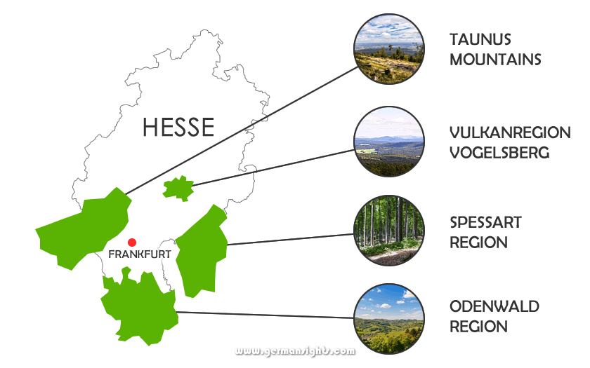
View from the Hoherodskopf peak in the Vogelsberg region
It may not compete with the Black Forest for recognition or with Bavaria for tourist infrastructure, but it has other strengths.
It offers space instead, a genuine rural pace, and a landscape shaped by forces active around 19 million years ago. The volcanic ring that erupted here has long since gone quiet, leaving behind layered basalt terraces, wooded slopes and unhurried stream valleys.
The Vogelsberg is a practical and underrated choice for independent travellers who want to walk, cycle and explore small towns without crowds.
The Vogelsberg massif is a collection of extinct volcanoes stacked and overlapping to form a broad, shield-shaped plateau, rather than a single cone. What was once an active volcanic region is now covered by forests, meadows and streams.
The Vogelsbergkreis district is the administrative heart of the area, and the two highest points - the Taufstein at 773 metres and the Hoherodskopf at 763 metres - both sit within the Naturpark Hoher Vogelsberg.
The area's geology is evident in the everyday details. Basalt walls line the fields. Dry stone walls mark farmland that has been cultivated for centuries.
The central plateau, known as the Oberwald, is almost entirely wooded, whereas the outer slopes are a mixture of pasture, arable fields and small settlements.
The region has good walking and cycling infrastructure, and has not been over-commercialised. It also works well as a base for exploring the area. Frankfurt is less than an hour away, and the Rhön Mountains are just east of the region.
The Vogelsberg can be visited as a destination in its own right or as part of a wider itinerary in Hesse.
The Vogelsberg is located between the towns of Alsfeld, Fulda, Büdingen and Nidda, putting it right in the centre of Hesse. Its location in the East Hesse Highlands means it is accessible from several directions, with the surrounding terrain ranging from highland basalt to lower river valleys and agricultural plains.
Four hiking areas around Frankfurt
The Rhön Mountains, with their higher elevations and different character, offer a complementary landscape just across the Fulda valley to the northeast.
To the northwest, the Vogelsberg gradually gives way to the West Hesse Highlands. To the south, the terrain drops into the Wetterau lowlands, eventually reaching the Rhine-Main region.
Travelling between these areas by road is straightforward, making the Vogelsberg an ideal location for a multi-region itinerary covering central and northern Hesse.
Regular regional trains run from Frankfurt Hauptbahnhof north-east through Fulda, stopping at towns including Lauterbach and, on a different line, Alsfeld.
Services are operated as part of the Hessian regional rail network and connections are generally reliable on weekdays. Weekend frequency can be lower on some branch lines, so check timetables in advance.
The A5 autobahn runs from north to south through western Hesse, providing the main route for travelling from Frankfurt to the Vogelsberg. The B49 and B276 are useful roads for crossing the massif itself.
The roads through the Oberwald are well maintained, but narrower than one might expect.
The Vogelsberg's story starts underground, long before any human presence. Volcanic activity shaped the region across millions of years, and the evidence of that process is still visible in the basalt that underpins almost every part of the landscape.
The Vogelsberg experienced its most intense volcanic activity during the Middle Miocene era, around 18.5 to 10 million years ago, peaking between 17 and 15 million years ago.
These eruptions were not explosive events, but rather a slow accumulation of overlapping basalt flows that built up the shield-shaped massif in layers. This resulted in a plateau with basalt terraces descending in rings from the Oberwald to the lower slopes.
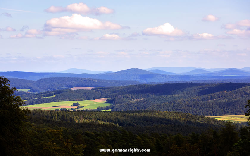
Extinct volcanoes in the Vogelsberg region
Erosion wore away much of the original extent of the basalt after the volcanic activity ended. The tropical weather conditions turned the volcanic rock into red clay in many places, while iron ore and bauxite deposits formed from the concentrated minerals in the basalt. Both have been mined commercially for centuries.
Extraction of basalt for use in road building and construction continues in some parts of the region today.
The fertile outer slopes of the Vogelsberg and its reliable water supply from spring-fed streams made the area attractive to early settlers. The upland fringe had supported farming communities long before the medieval period.
Dry stone walls, built from locally sourced basalt, can still be seen across the agricultural land. Some of these walls mark boundaries that date back centuries.
The Vogelsberg was located between significant trade routes connecting the Rhine-Main region with northern and eastern Germany during the medieval period.
Market towns developed at key crossing points. Alsfeld, with its well-preserved half-timbered houses and central market square, grew as an important trading stop on routes through central Hesse.
Other towns such as Lauterbach and Schlitz also developed as local centres with their own castles and civic buildings.
The Naturpark Hoher Vogelsberg covers the high central plateau. The main attractions are the hiking trails, cycling routes and viewpoints, while a handful of small towns add cultural interest. The area is also home to significant flora and fauna, including protected meadow landscapes known as Bergmähwiesen, heathland areas, and wetland habitats.
The Hoherodskopf, at 763 metres, is the more developed of the two main peaks. It has a car park, a viewing tower and a summer toboggan run, making it popular with families. On clear days, the views extend well beyond the massif.
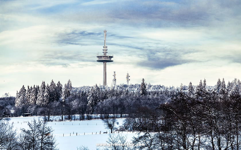
The Hoherodskopf in winter
The Taufstein, which is 10 metres higher at 773 metres, is the official highest point of the Vogelsberg. The surrounding beech woodland, which is part of the Taufstein Nature Reserve, has been left unmanaged since 1906. The northern slopes of the Taufstein boast impressive basalt rock formations that are well worth seeing.
A short walk from the Hoherodskopf leads to the rocky outcrop of the Geiselstein, which provides an unobstructed view of the surrounding area without requiring a long hike.
The Naturpark boasts an extensive network of signposted trails. The Vulkanring is a long-distance circular route which loops around the volcanic landscape, linking some of the massif's most significant geographical features. Trail signage is generally good.
The Vulkanradweg is a dedicated cycle path which winds its way through the volcanic landscape of the Vogelsberg region. It is accessible to riders of most fitness levels, particularly on the outer slopes where the gradients are moderate. The broader cycling network connects to nearby river valleys and routes extending towards Fulda and the Rhön.
Schotten is the main town in the High Vogelsberg region and an ideal base for exploring the surrounding trails and nature reserve. It has a compact historic centre, local accommodation and good access to the walking trails.
Ulrichstein is smaller and sits at a higher elevation of around 570 metres, making it one of the highest towns in Hesse. Its elevated position provides sweeping views of the surrounding uplands, and the town's unpolished character suits independent travellers better than a more commercially developed resort.
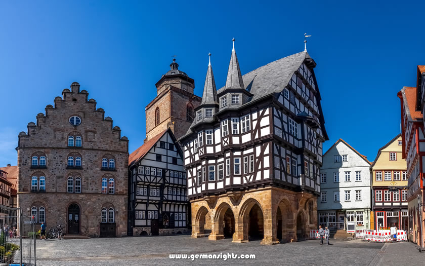
The historic centre of Alsfeld
Alsfeld, on the northwestern edge of the massif, is worth a half-day visit to see its medieval market square and half-timbered streetscape, one of the best-preserved in Hesse.
The Bergmähwiesen are one of the Vogelsberg's most distinctive habitats. These traditional mountain meadows are managed by seasonal cutting rather than intensive farming. They support a variety of plant species that have disappeared from much of lowland Germany.